
Zoersel topographic map
Interactive map
Click on the map to display elevation.
About this map
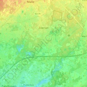
Name: Zoersel topographic map, elevation, terrain.
Location: Zoersel, Antwerpen, Vlaanderen, 2980, België (51.21892 4.60786 51.29386 4.74334)
Average elevation: 15 m
Minimum elevation: 3 m
Maximum elevation: 29 m
Other topographic maps
Click on a map to view its topography, its elevation and its terrain.
Zoerselbos
België > Vlaanderen > Zoersel
Zoerselbos, Antwerpsedreef, Zoersel, Antwerpen, Vlaanderen, 2980, België
Average elevation: 14 m