
Clontymore topographic map
Interactive map
Click on the map to display elevation.
About this map
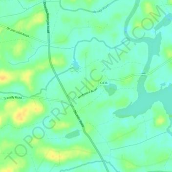
Name: Clontymore topographic map, elevation, terrain.
Average elevation: 48 m
Minimum elevation: 39 m
Maximum elevation: 64 m
Other topographic maps
Click on a map to view its topography, its elevation and its terrain.
Clonturkle
Royaume-Uni > Irlande du Nord > Kinawley
Clonturkle, Springtown ED, Kinawley, County Fermanagh, Irlande du Nord, Royaume-Uni
Average elevation: 116 m
Portbeg
Royaume-Uni > Irlande du Nord > Kinawley
Portbeg, Kinawley, County Fermanagh, Irlande du Nord, Royaume-Uni
Average elevation: 47 m
Clontelaghan
Royaume-Uni > Irlande du Nord > Kinawley
Clontelaghan, Kinawley, County Fermanagh, Irlande du Nord, Royaume-Uni
Average elevation: 68 m