
Thank you for supporting this site ❤️
Make a donation
Make a donation
Joe Neets topographic map
Click on the map to display elevation.
Thank you for supporting this site ❤️
Make a donation
Make a donation
About this map
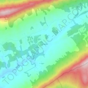
Name: Joe Neets topographic map, elevation, terrain.
Location: Joe Neets, Tazewell County, Virginia, United States (37.06262 -81.49844 37.10262 -81.45844)
Average elevation: 963 m
Minimum elevation: 820 m
Maximum elevation: 1,284 m
Thank you for supporting this site ❤️
Make a donation
Make a donation
Other topographic maps
Click on a map to view its topography, its elevation and its terrain.