
Culp Creek topographic map
Interactive map
Click on the map to display elevation.
About this map
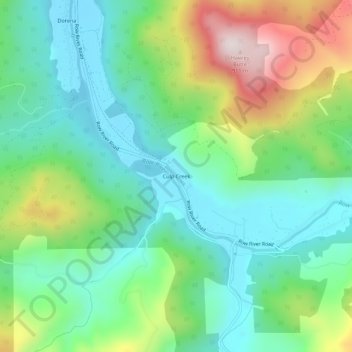
Name: Culp Creek topographic map, elevation, terrain.
Location: Culp Creek, Lane County, Oregon, 97434, United States (43.68346 -122.86757 43.72346 -122.82757)
Average elevation: 474 m
Minimum elevation: 275 m
Maximum elevation: 915 m