Geolocate

Kadampuzha topographic map

Click on the map to display elevation.

About this map

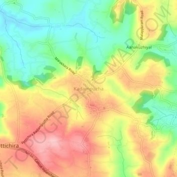
Name: Kadampuzha topographic map, elevation, terrain.

Location: Kadampuzha, Tirur, Malappuram, Kerala, 676553, India (10.92190 76.02260 10.96190 76.06260)

Average elevation: 91 m

Minimum elevation: 15 m

Maximum elevation: 170 m

Other topographic maps

Click on a map to view its topography, its elevation and its terrain.

Puthanathani

India > Kerala > Tirur

Average elevation: 83 m

Kanthaloor Palli Kulam

India > Kerala > Tirur > Tirur

Average elevation: 26 m

Paravanna Vadakke Palli Kulam

India > Kerala > Tirur

Average elevation: 7 m

Kanthaloor Palli Kulam

India > Kerala > Tirur > Tirur

Average elevation: 26 m

Thirunavaya

India > Kerala > Tirur

Average elevation: 10 m

Nambikulam

India > Kerala > Tirur

Average elevation: 40 m