
Thank you for supporting this site ❤️
Make a donation
Make a donation
Portada de la Sierra topographic map
Click on the map to display elevation.
Thank you for supporting this site ❤️
Make a donation
Make a donation
About this map
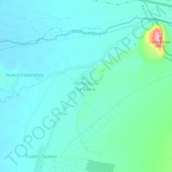
Name: Portada de la Sierra topographic map, elevation, terrain.
Location: Portada de la Sierra, San José, Pacasmayo, La Libertad, Perú (-7.35983 -79.40474 -7.31983 -79.36474)
Average elevation: 145 m
Minimum elevation: 113 m
Maximum elevation: 320 m
Thank you for supporting this site ❤️
Make a donation
Make a donation