
Mount of Beatitudes topographic map
Interactive map
Click on the map to display elevation.
About this map
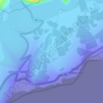
Name: Mount of Beatitudes topographic map, elevation, terrain.
Average elevation: -128 m
Minimum elevation: -219 m
Maximum elevation: 29 m
The site known as the Mount of Beatitudes is on the northwestern shore of the Sea of Galilee, between Capernaum and the archeological site of Gennesaret (Ginosar), on the southern slopes of the Korazim Plateau. Its negative altitude (around 25 metres below sea level, nearly 200 metres above the Sea of Galilee) makes it one of the lowest summits of the world. This site, very near Tabgha and also known as Mount Eremos, has been commemorated for more than 1600 years. Other suggested locations for the Jesus' Sermon on the Mount have included the nearby Mount Arbel, or even the Horns of Hattin.