
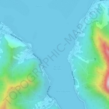
Baie d’Opunohu topographic map
Interactive map
Click on the map to display elevation.
About this map
Name: Baie d’Opunohu topographic map, elevation, terrain.
Average elevation: 79 m
Minimum elevation: 0 m
Maximum elevation: 551 m
Other topographic maps
Click on a map to view its topography, its elevation and its terrain.
Mai’ao
France, Polynésie française (eaux territoriales) > Polynésie française > Moorea-Maiao
Mai’ao, Moorea-Maiao, Îles du Vent, Polynésie française, France, Polynésie française (eaux territoriales)
Average elevation: 6 m