
Make a donation
Calipatria topographic map
Click on the map to display elevation.
Make a donation
Calipatria
At an elevation of 180 feet (55 m) below sea level, Calipatria is the lowest incorporated city in the Western Hemisphere. The city currently claims to have the "tallest flagpole (184 feet) where the flag flies at sea level" at 184 feet (56 m), so their American flag will always fly above sea level. According to the Guinness Book of World Records, the Jeddah Flagpole holds the title of world's tallest, but it is entirely above sea level.
Make a donation
About this map
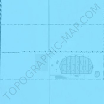
Name: Calipatria topographic map, elevation, terrain.
Location: Calipatria, Imperial County, California, United States (33.16198 -115.50852 33.17660 -115.47595)
Average elevation: -50 m
Minimum elevation: -55 m
Maximum elevation: -45 m
Make a donation
Other topographic maps
Click on a map to view its topography, its elevation and its terrain.
Salton City
United States > California > Imperial County
In the 1970s, most of the buildings constructed along the shoreline, including the city's marina were abandoned due to rising sea elevation. In the 1980s, the Imperial Irrigation District took proactive water conservation measures to reduce the flow of unused canal water into the Salton Sea. Throughout the…
Average elevation: -40 m
Make a donation
Seeley
United States > California > Imperial County
NAF El Centro, the winter home of the Blue Angels, was built adjacent to Seeley in 1946. In 1964, Interstate 8 was run a mile south of Seeley, marking the lowest elevation on the Interstate Highway System at -52 feet.
Average elevation: -12 m
Make a donation
Make a donation
Dixieland
United States > California > Imperial County
Dixieland is an unincorporated community in Imperial County, California. The name was likely a reference to the Pima cotton fields in the area. It is located 5 miles (8 km) east of Plaster City on County Route S80, at an elevation of 36 feet (11 m) below sea level.
Average elevation: -3 m
Felicity
United States > California > Imperial County
Felicity is an unincorporated community in Imperial County, California. The town was established in 1986 by Jacques-Andre Istel who bought the land in the 1950s and developed it in the 1980s after selling off his parachute business. The town is "Dedicated to Remembrance" and named for Istel's wife Felicia. It…
Average elevation: 89 m
Make a donation
Make a donation
Make a donation
Tumco
United States > California > Imperial County
Hedges, later renamed Tumco, is a locale, a ghost town, site of a former mining town, in Imperial County, California. It lies at an elevation of 617 feet / 188 meters along the Tumco Wash in the Cargo Muchacho Mountains. Nearby is the Hedges Cemetery at an elevation of 643 feet (196 meters), at 32°53′04″N…
Average elevation: 201 m
Make a donation
Make a donation