
Schmitten topographic map
Interactive map
Click on the map to display elevation.
About this map
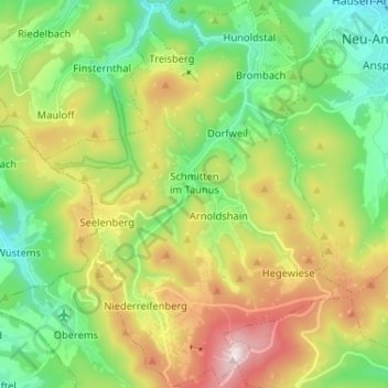
Name: Schmitten topographic map, elevation, terrain.
Location: Schmitten, Hochtaunuskreis, Hessen, 61389, Duitsland (50.22567 8.39520 50.30825 8.49762)
Average elevation: 525 m
Minimum elevation: 314 m
Maximum elevation: 884 m