
Masaka topographic map
Interactive map
Click on the map to display elevation.
About this map
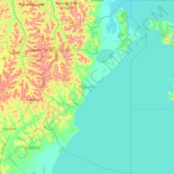
Name: Masaka topographic map, elevation, terrain.
Location: Masaka, Central Region, Ouganda (-0.81595 31.58329 -0.15100 32.06064)
Average elevation: 1,171 m
Minimum elevation: 1,129 m
Maximum elevation: 1,344 m