
Thank you for supporting this site ❤️
Make a donation
Make a donation
Molina topographic map
Click on the map to display elevation.
Thank you for supporting this site ❤️
Make a donation
Make a donation
About this map
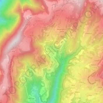
Name: Molina topographic map, elevation, terrain.
Location: Molina, Fumane, Верона, Венето, 37022, Италия (45.59234 10.89115 45.63234 10.93115)
Average elevation: 713 m
Minimum elevation: 241 m
Maximum elevation: 1,003 m
Thank you for supporting this site ❤️
Make a donation
Make a donation
Other topographic maps
Click on a map to view its topography, its elevation and its terrain.