
Thank you for supporting this site ❤️
Make a donation
Make a donation
Half Assini topographic map
Click on the map to display elevation.
Thank you for supporting this site ❤️
Make a donation
Make a donation
About this map
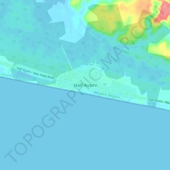
Name: Half Assini topographic map, elevation, terrain.
Location: Half Assini, Jomoro Municipal District, Western Region, Ghana (5.01135 -2.92517 5.09135 -2.84517)
Average elevation: 7 m
Minimum elevation: -2 m
Maximum elevation: 79 m
Thank you for supporting this site ❤️
Make a donation
Make a donation