
Pilzno topographic map
Interactive map
Click on the map to display elevation.
About this map
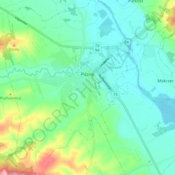
Name: Pilzno topographic map, elevation, terrain.
Average elevation: 222 m
Minimum elevation: 188 m
Maximum elevation: 319 m
Other topographic maps
Click on a map to view its topography, its elevation and its terrain.
Międzylesie
Poland > Subcarpathian Voivodeship > Dębica County > Zasów
Międzylesie, Zasów, gmina Żyraków, Dębica County, Subcarpathian Voivodeship, 39-209, Poland
Average elevation: 224 m
Dębica
Poland > Subcarpathian Voivodeship > Dębica County > Dębica
Dębica, Dębica County, Subcarpathian Voivodeship, 39-200, Poland
Average elevation: 234 m