
Lüdenscheid topographic map
Interactive map
Click on the map to display elevation.
About this map
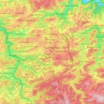
Name: Lüdenscheid topographic map, elevation, terrain.
Location: Lüdenscheid, Märkischer Kreis, Noordrijn-Westfalen, Duitsland (51.15512 7.55221 51.27076 7.72326)
Average elevation: 384 m
Minimum elevation: 161 m
Maximum elevation: 587 m