
Redlands topographic map
Interactive map
Click on the map to display elevation.
About this map
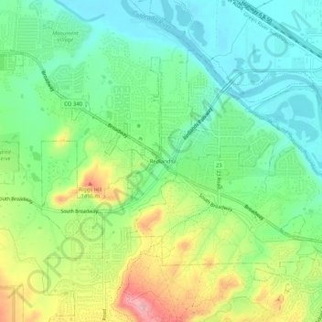
Name: Redlands topographic map, elevation, terrain.
Location: Redlands, Mesa County, Colorado, 81507, USA (39.05887 -108.65565 39.09887 -108.61565)
Average elevation: 1,425 m
Minimum elevation: 1,373 m
Maximum elevation: 1,522 m