
Thank you for supporting this site ❤️
Make a donation
Make a donation
Río Gallegos topographic map
Click on the map to display elevation.
Thank you for supporting this site ❤️
Make a donation
Make a donation
About this map
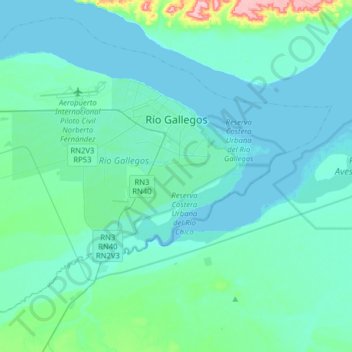
Name: Río Gallegos topographic map, elevation, terrain.
Location: Río Gallegos, Güer Aike, Santa Cruz Province, Argentina (-51.74343 -69.39219 -51.56647 -69.07622)
Average elevation: 16 m
Minimum elevation: 0 m
Maximum elevation: 142 m
Thank you for supporting this site ❤️
Make a donation
Make a donation
Other topographic maps
Click on a map to view its topography, its elevation and its terrain.