Argentina topographic maps
Click on a map to view its topography, its elevation and its terrain.


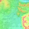
Salta
Salta has a subtropical highland climate (Cwb, according to the Köppen climate classification), and it is characterized by pleasant weather year-round. Located in the subtropical north, but at an altitude of 1,200 metres, Salta enjoys 4 distinct seasons: summers are warm with frequent thunderstorms, with…
Average elevation: 1,270 m


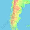
Patagonia
Across much of Patagonia east of the Andes, volcanic eruptions have created formation of basaltic lava plateaus during the Cenozoic. The plateaus are of different ages with the older –of Neogene and Paleogene age– being located at higher elevations than Pleistocene and Holocene lava plateaus and outcrops.
Average elevation: 173 m


Capilla del Monte
Argentina > Córdoba > Pedanía Dolores
Cerro Uritorco is the highest mountain in the Sierras Chicas mountain range, with an elevation of 1900 meters above sea level. Even though the government of Capilla del Monte has tried to expropriate Cerro Uritorco, it continues to have a private administration, and both tourists and locals have to pay an…
Average elevation: 1,017 m


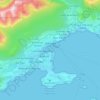
Ushuaia
Argentina > Tierra del Fuego Province > Ushuaia
Several ski areas are located near Ushuaia including Glacier El Martial (on Martial Mountains) and Cerro Castor. Opened in 1999, Cerro Castor is the southernmost full-fledged ski resort in the world. On Cerro Castor, it is possible to ski just 200 metres (660 feet) above sea level. The summit reaches an…
Average elevation: 232 m




Andes
Argentina > Mendoza > Distrito Las Cuevas
The Andes Mountains are the highest mountain range outside Asia. The highest mountain outside Asia, Argentina's Mount Aconcagua, rises to an elevation of about 6,961 m (22,838 ft) above sea level. The peak of Chimborazo in the Ecuadorian Andes is farther from the Earth's center than any other location on the…
Average elevation: 6,208 m
Mendoza
Argentina > Mendoza > Sección 2ª Barrio Cívico
Argentina's Malbec wines originate from Mendoza's high-altitude wine regions of Lujan de Cuyo and the Uco Valley. These districts are located in the foothills of the Andes mountains between 2,800 and 5,000 feet elevation. Vintner Nicolas Catena Zapata is considered the pioneer of high-altitude growing and was…
Average elevation: 890 m


Santa Cruz
From the centre to the Atlantic coast in the east, the landscape is dominated by plateaux. These plateaux are made up of basalt rock occurring in stepped sequences. The plateaux are of different ages, with the older –of Neogene and Paleogene age– being located at higher elevations than Pleistocene and…
Average elevation: 351 m


San Juan
San Juan is ranked second among the wine-producing provinces of Argentina. It has a cultivated area of 116,700 acres at altitudes of between 1,970 (601m) and 4,590 feet (1399m) above sea level. This region specializes in Syrah, Malbec, Cabernet Sauvignon, Bonarda, Chardonnay and Torrontés. Because of this…
Average elevation: 694 m


Cordoba
Argentina > Córdoba > Pedanía Capital
The wealthier suburbs west of the city are located at slightly higher altitudes, which allows cool breezes to blow in the summer, bringing drier, comfortable nights during hotter periods, and more regular frost in the winter. Generally speaking, Córdoba's daytime temperatures are very slightly warmer than…
Average elevation: 457 m


Los Glaciares National Park
The park has a cool and moist temperate climate. Mean temperatures range from 0.6 °C (33.1 °F) in winter to 13.4 °C (56.1 °F) in summer although at higher altitudes, the mean annual temperature can be around −3 °C (26.6 °F). The park receives an average annual rainfall of 500 mm (20 in) in the west and…
Average elevation: 752 m


Catamarca
The province is located in the semi–arid region of Argentina. Mean annual precipitation of the province is around 400 to 500 mm (16 to 20 in) which decreases significantly to the west. The province is characterized by the presence of different microclimates based on variations in altitude. In general, there…
Average elevation: 2,292 m




Distrito Ciudad de Tupungato
Argentina > Mendoza > Distrito Ciudad de Tupungato
Average elevation: 1,078 m


Staten Island
Argentina > Tierra del Fuego Province
Temperatures are low year round but without extreme minimum temperatures. The mean temperature in summer is 8.3 °C (46.9 °F) with mean extremes of 16.2 °C (61.2 °F) and 3.0 °C (37.4 °F) while in winter, the mean temperature is 3.3 °C (37.9 °F) with mean extremes of 7.7 °C (45.9 °F) and −4 °C (24.8…
Average elevation: 23 m


Municipio de San Antonio de los Cobres
The town is known for its high elevation of approximately 3,775 meters (12,385 feet) above sea level, being one of the highest elevations of any city or town in Argentina. It is located approximately 160 kilometers (99 mi) from the city of Salta and 2,000 kilometers (1,200 mi) from the capital, Buenos Aires.…
Average elevation: 3,733 m

Parque Nacional Tierra del Fuego
Argentina > Tierra del Fuego Province
The park has dramatic scenery, with waterfalls, forests, mountains, and glaciers. Its 630 km2 (240 sq mi) include parts of the Fagnano and Roca lakes. The Senda Costera (Coastal Path), connecting Ensenada Bay to Lapataia Bay on Lago Roca, is a popular hiking trail within the park. Forests of Antarctic beech,…
Average elevation: 460 m