
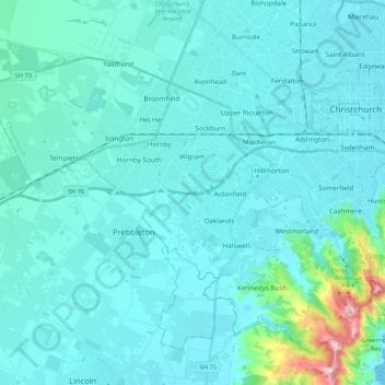
Halswell-Hornby-Riccarton Community topographic map
Interactive map
Click on the map to display elevation.
About this map
Name: Halswell-Hornby-Riccarton Community topographic map, elevation, terrain.
Average elevation: 49 m
Minimum elevation: 0 m
Maximum elevation: 526 m
Other topographic maps
Click on a map to view its topography, its elevation and its terrain.
Port Levy
Nouvelle-Zélande > Canterbury > Christchurch City > Banks Peninsula Community
Port Levy, Banks Peninsula Community, Christchurch City, Canterbury, Nouvelle-Zélande
Average elevation: 249 m