
Geraldine topographic map
Interactive map
Click on the map to display elevation.
About this map
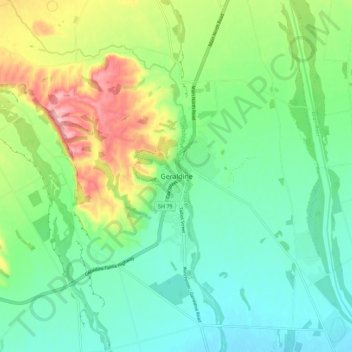
Name: Geraldine topographic map, elevation, terrain.
Average elevation: 130 m
Minimum elevation: 78 m
Maximum elevation: 243 m
Other topographic maps
Click on a map to view its topography, its elevation and its terrain.
Winchester
Nouvelle-Zélande > Canterbury > Timaru District
Winchester, Timaru District, Canterbury, Nouvelle-Zélande
Average elevation: 46 m
Timaru
Nouvelle-Zélande > Canterbury > Timaru District
Timaru, Timaru District, Canterbury, 7910, Nouvelle-Zélande
Average elevation: 16 m