
Thank you for supporting this site ❤️
Make a donation
Make a donation
Svendsvika topographic map
Click on the map to display elevation.
Thank you for supporting this site ❤️
Make a donation
Make a donation
About this map
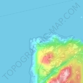
Name: Svendsvika topographic map, elevation, terrain.
Location: Svendsvika, Farsund, Агдер, Норвегия (58.17778 6.62813 58.17788 6.62823)
Average elevation: 34 m
Minimum elevation: -1 m
Maximum elevation: 218 m
Thank you for supporting this site ❤️
Make a donation
Make a donation
Other topographic maps
Click on a map to view its topography, its elevation and its terrain.