
田海子山 topographic map
Interactive map
Click on the map to display elevation.
About this map
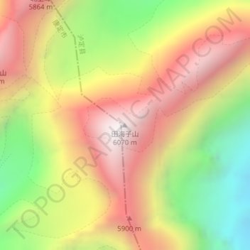
Name: 田海子山 topographic map, elevation, terrain.
Average elevation: 5,278 m
Minimum elevation: 4,430 m
Maximum elevation: 6,026 m
Other topographic maps
Click on a map to view its topography, its elevation and its terrain.
Mount Gongga
China > Sichuan > Luding County
Mount Gongga, Luding County, Kardze, Sichuan, 626100, China
Average elevation: 6,496 m