
Thank you for supporting this site ❤️
Make a donation
Make a donation
Radan topographic map
Click on the map to display elevation.
Thank you for supporting this site ❤️
Make a donation
Make a donation
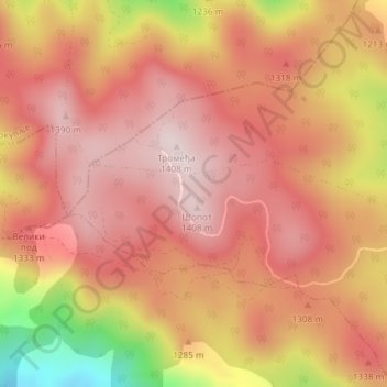
Radan
Radan (Serbian Cyrillic: Радан) is a mountain in southern Serbia, near the town of Kuršumlija. Its highest peak, Šopot, has an elevation of 1,408 meters above sea level.
Thank you for supporting this site ❤️
Make a donation
Make a donation
About this map
Name: Radan topographic map, elevation, terrain.
Average elevation: 1,272 m
Minimum elevation: 984 m
Maximum elevation: 1,402 m
Thank you for supporting this site ❤️
Make a donation
Make a donation