
Lac-à-l'Eau-Claire topographic map
Interactive map
Click on the map to display elevation.
About this map
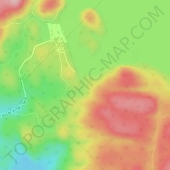
Name: Lac-à-l'Eau-Claire topographic map, elevation, terrain.
Average elevation: 264 m
Minimum elevation: 164 m
Maximum elevation: 359 m
Other topographic maps
Click on a map to view its topography, its elevation and its terrain.
Lac des Souris
Canada > Québec > Saint-Élie-de-Caxton
Lac des Souris, Chemin de l'Amitié, Saint-Élie-de-Caxton, Maskinongé (MRC), Mauricie, Québec, Canada
Average elevation: 222 m