
Thank you for supporting this site ❤️
Make a donation
Make a donation
Lindenfels topographic map
Click on the map to display elevation.
Thank you for supporting this site ❤️
Make a donation
Make a donation
About this map
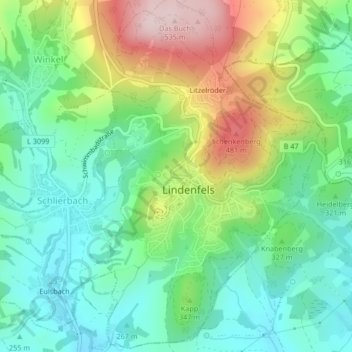
Name: Lindenfels topographic map, elevation, terrain.
Location: Lindenfels, Kreis Bergstraße, Hesse, 64678, Alemania (49.68499 8.77874 49.68509 8.77884)
Average elevation: 321 m
Minimum elevation: 213 m
Maximum elevation: 530 m
Thank you for supporting this site ❤️
Make a donation
Make a donation