
Thank you for supporting this site ❤️
Make a donation
Make a donation
Los Cedros topographic map
Click on the map to display elevation.
Thank you for supporting this site ❤️
Make a donation
Make a donation
About this map
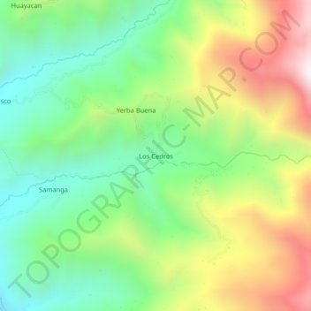
Name: Los Cedros topographic map, elevation, terrain.
Location: Los Cedros, Colasay, Jaén, Cajamarca, Perú (-5.78572 -79.02954 -5.74572 -78.98954)
Average elevation: 1,551 m
Minimum elevation: 1,108 m
Maximum elevation: 2,252 m
Thank you for supporting this site ❤️
Make a donation
Make a donation
Other topographic maps
Click on a map to view its topography, its elevation and its terrain.