
Fanø topographic map
Interactive map
Click on the map to display elevation.
About this map
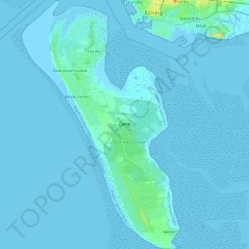
Name: Fanø topographic map, elevation, terrain.
Location: Fanø, Sønderho, Fanø Kommune, Region Süddänemark, 6720, Dänemark (55.33933 8.32751 55.47272 8.47961)
Average elevation: 1 m
Minimum elevation: -15 m
Maximum elevation: 25 m