
Le Bois Neuf topographic map
Interactive map
Click on the map to display elevation.
About this map
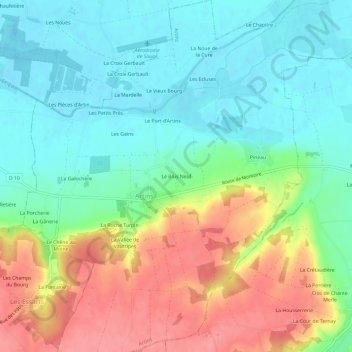
Name: Le Bois Neuf topographic map, elevation, terrain.
Average elevation: 88 m
Minimum elevation: 57 m
Maximum elevation: 139 m
Other topographic maps
Click on a map to view its topography, its elevation and its terrain.
Les Carrois Maillards
France > Centre-Val de Loire > Loir-et-Cher > Artins
Les Carrois Maillards, Artins, Vendôme, Loir-et-Cher, Centre-Val de Loire, France métropolitaine, 41800, France
Average elevation: 89 m