
Thank you for supporting this site ❤️
Make a donation
Make a donation
Sala Dan topographic map
Click on the map to display elevation.
Thank you for supporting this site ❤️
Make a donation
Make a donation
About this map
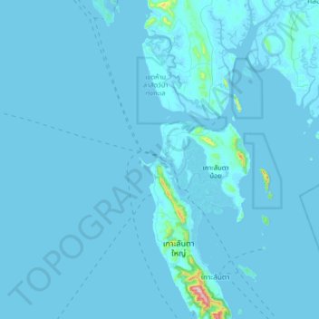
Name: Sala Dan topographic map, elevation, terrain.
Location: Sala Dan, Ko Lanta, Krabi Province, 81550, Thailand (7.48928 98.87785 7.80928 99.19785)
Average elevation: 8 m
Minimum elevation: -4 m
Maximum elevation: 467 m
Thank you for supporting this site ❤️
Make a donation
Make a donation
Other topographic maps
Click on a map to view its topography, its elevation and its terrain.