
Thank you for supporting this site ❤️
Make a donation
Make a donation
South Weald topographic map
Click on the map to display elevation.
Thank you for supporting this site ❤️
Make a donation
Make a donation
About this map
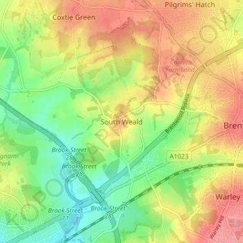
Name: South Weald topographic map, elevation, terrain.
Location: South Weald, Brentwood, Essex, England, CM14 5QJ, United Kingdom (51.60076 0.24901 51.64076 0.28901)
Average elevation: 73 m
Minimum elevation: 30 m
Maximum elevation: 117 m
Thank you for supporting this site ❤️
Make a donation
Make a donation
Other topographic maps
Click on a map to view its topography, its elevation and its terrain.