
Thank you for supporting this site ❤️
Make a donation
Make a donation
Malegaon topographic map
Click on the map to display elevation.
Thank you for supporting this site ❤️
Make a donation
Make a donation
Malegaon
Malegaon(previously Maligaon) is at the confluence of the Girna and Mosam (previously Moosy) rivers, at elevation of 438 metres (1437 feet) at 18°25′N 77°32′E / 18.42°N 77.53°E / 18.42; 77.53.
Thank you for supporting this site ❤️
Make a donation
Make a donation
About this map
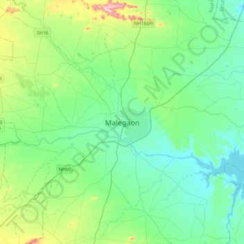
Name: Malegaon topographic map, elevation, terrain.
Average elevation: 463 m
Minimum elevation: 387 m
Maximum elevation: 749 m
Thank you for supporting this site ❤️
Make a donation
Make a donation