
San Miguel topographic map
Interactive map
Click on the map to display elevation.
About this map
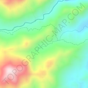
Name: San Miguel topographic map, elevation, terrain.
Location: San Miguel, Alejandría, Oriente, Antioquia, Colombia (6.37925 -75.08799 6.39925 -75.06799)
Average elevation: 1,529 m
Minimum elevation: 1,341 m
Maximum elevation: 1,812 m
Other topographic maps
Click on a map to view its topography, its elevation and its terrain.
Río Nare
Colombia > Antioquia > Alejandría > Alejandría
Río Nare, Alejandría, Oriente, Antioquia, Colombia
Average elevation: 1,624 m