
Thank you for supporting this site ❤️
Make a donation
Make a donation
Jackson topographic map
Click on the map to display elevation.
Thank you for supporting this site ❤️
Make a donation
Make a donation
About this map
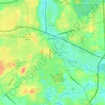
Name: Jackson topographic map, elevation, terrain.
Location: Jackson, Jackson County, Michigan, United States (42.20368 -84.43456 42.27087 -84.35663)
Average elevation: 296 m
Minimum elevation: 278 m
Maximum elevation: 322 m
Thank you for supporting this site ❤️
Make a donation
Make a donation
Other topographic maps
Click on a map to view its topography, its elevation and its terrain.