
La Alameda topographic map
Interactive map
Click on the map to display elevation.
About this map
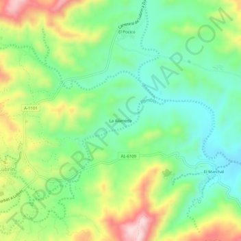
Name: La Alameda topographic map, elevation, terrain.
Location: La Alameda, Lubrín, Almería, Andalusië, 04271, Spanje (37.20423 -2.06322 37.24423 -2.02322)
Average elevation: 480 m
Minimum elevation: 357 m
Maximum elevation: 693 m