
Tooting topographic map
Interactive map
Click on the map to display elevation.
About this map
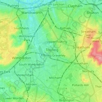
Name: Tooting topographic map, elevation, terrain.
Location: Tooting, Londen, Greater London, Engeland, SW17 0SU, VK (51.38666 -0.20908 51.46666 -0.12908)
Average elevation: 30 m
Minimum elevation: 0 m
Maximum elevation: 100 m