
Thank you for supporting this site ❤️
Make a donation
Make a donation
Doti topographic map
Click on the map to display elevation.
Thank you for supporting this site ❤️
Make a donation
Make a donation
About this map
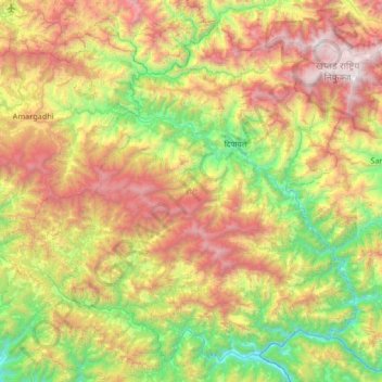
Name: Doti topographic map, elevation, terrain.
Location: Doti, Sudurpashchim Province, Nepal (28.93102 80.52604 29.44403 81.18696)
Average elevation: 1,451 m
Minimum elevation: 300 m
Maximum elevation: 3,273 m
Thank you for supporting this site ❤️
Make a donation
Make a donation
Other topographic maps
Click on a map to view its topography, its elevation and its terrain.