
Capel Curig topographic map
Interactive map
Click on the map to display elevation.
About this map
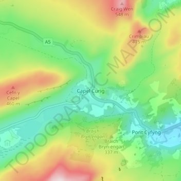
Name: Capel Curig topographic map, elevation, terrain.
Location: Capel Curig, Conwy, Pays de Galles, LL24 0EN, Royaume-Uni (53.08505 -3.93235 53.12505 -3.89235)
Average elevation: 299 m
Minimum elevation: 139 m
Maximum elevation: 566 m
Other topographic maps
Click on a map to view its topography, its elevation and its terrain.
Capel Curig
Royaume-Uni > Pays de Galles > Conwy
Capel Curig, Conwy, Pays de Galles, Royaume-Uni
Average elevation: 449 m