
Doninhas topographic map
Interactive map
Click on the map to display elevation.
About this map
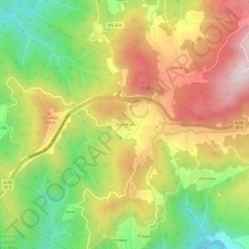
Name: Doninhas topographic map, elevation, terrain.
Location: Doninhas, Talhadas, Sever do Vouga, Aveiro, 3740-412, Portugal (40.64571 -8.35675 40.68571 -8.31675)
Average elevation: 385 m
Minimum elevation: 99 m
Maximum elevation: 676 m
Other topographic maps
Click on a map to view its topography, its elevation and its terrain.
Silveira
Portugal > Aveiro > Sever do Vouga > Talhadas
Silveira, Talhadas, Sever do Vouga, Aveiro, 3740-412, Portugal
Average elevation: 445 m
Boucinha
Portugal > Aveiro > Sever do Vouga > Talhadas
Boucinha, Talhadas, Sever do Vouga, Aveiro, 3740-412, Portugal
Average elevation: 395 m