
Thank you for supporting this site ❤️
Make a donation
Make a donation
Alvarado topographic map
Click on the map to display elevation.
Thank you for supporting this site ❤️
Make a donation
Make a donation
About this map
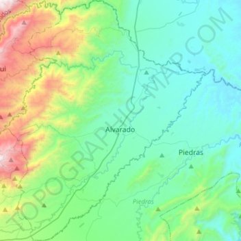
Name: Alvarado topographic map, elevation, terrain.
Location: Alvarado, Centro, Tolima, RAP (Especial) Central, Colombia (4.44941 -75.07627 4.70338 -74.86238)
Average elevation: 649 m
Minimum elevation: 241 m
Maximum elevation: 2,119 m
Thank you for supporting this site ❤️
Make a donation
Make a donation
Other topographic maps
Click on a map to view its topography, its elevation and its terrain.