
Lancaster topographic map
Interactive map
Click on the map to display elevation.
About this map
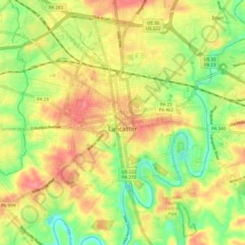
Name: Lancaster topographic map, elevation, terrain.
Average elevation: 102 m
Minimum elevation: 65 m
Maximum elevation: 135 m
Other topographic maps
Click on a map to view its topography, its elevation and its terrain.
New Holland
Estados Unidos da América > Pensilvânia > Lancaster County
New Holland, Lancaster County, Pensilvânia, 17557, Estados Unidos da América
Average elevation: 144 m