Geolocate

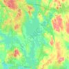
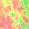
Halli topographic map

Click on the map to display elevation.

About this map

Name: Halli topographic map, elevation, terrain.

Location: Halli, Jämsä, Jämsä sub-region, Central Finland, Mainland Finland, 35600, Finland (61.82131 24.78839 61.90131 24.86839)

Average elevation: 137 m

Minimum elevation: 98 m

Maximum elevation: 208 m

Other topographic maps

Click on a map to view its topography, its elevation and its terrain.

Jyväskylä

Finland > Central Finland

Average elevation: 130 m

Jyväskylä

Finland > Central Finland

Average elevation: 130 m

Muuratsalo

Finland > Central Finland > Jyväskylä

Average elevation: 94 m

Keurusselkä

Finland > Central Finland

Average elevation: 131 m

Jämsä

Finland > Central Finland

Average elevation: 125 m

Äänekoski

Finland > Central Finland

Average elevation: 135 m

Kyyjärvi

Finland > Central Finland

Average elevation: 181 m

Säynätsalo

Finland > Central Finland > Jyväskylä

Average elevation: 85 m

Keuruu

Finland > Central Finland

Average elevation: 154 m

Säynätsalo

Finland > Central Finland > Jyväskylä

Average elevation: 85 m

Laukaa

Finland > Central Finland

Average elevation: 124 m

Keuruu

Finland > Central Finland

Average elevation: 154 m

Muuratsalo

Finland > Central Finland > Jyväskylä

Average elevation: 94 m

Muuratsalo

Finland > Central Finland > Jyväskylä

Average elevation: 94 m

Jyväskylä

Finland > Central Finland

Average elevation: 130 m

Jyväskylä

Finland > Central Finland

Average elevation: 130 m

Rimminlampi

Finland > Central Finland > Jyväskylä

Average elevation: 109 m

Huopanankoski

Finland > Central Finland > Viitasaari > Huopanankoski

Huopana is located on the waterway from Lake Kivijärvi to Lake Keitele. The rapids consist of a narrow forked stream flowing from Lake Vuosjärvi to Lake Muuruejärvi with a total elevation difference of 6.5 metres (21 ft). The left fork of the rapids is in a nearly natural state. The right fork has been…

Average elevation: 108 m
Karstula

Finland > Central Finland

Average elevation: 178 m