
Radicale topographic map
Interactive map
Click on the map to display elevation.
About this map
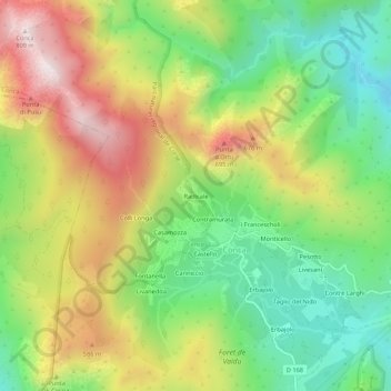
Name: Radicale topographic map, elevation, terrain.
Average elevation: 388 m
Minimum elevation: 84 m
Maximum elevation: 789 m
Other topographic maps
Click on a map to view its topography, its elevation and its terrain.
Refuge d'i Paliri
France > Corse > Corse-du-Sud > Conca > Radicale
Refuge d'i Paliri, GR 20, Pascialella, Radicale, Conca, Sartène, Corse-du-Sud, Corse, France métropolitaine, 20135, France
Average elevation: 858 m