
Boom topographic map
Interactive map
Click on the map to display elevation.
About this map
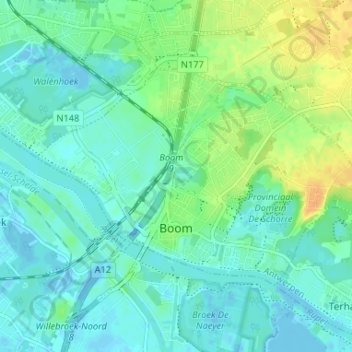
Name: Boom topographic map, elevation, terrain.
Location: Boom, Anvers, Flandre, 2850, Belgique (51.08065 4.34068 51.10620 4.40623)
Average elevation: 8 m
Minimum elevation: -14 m
Maximum elevation: 28 m
Other topographic maps
Click on a map to view its topography, its elevation and its terrain.
Borgerhout
Belgique > Anvers > Anvers > Anvers
Borgerhout, Anvers, Flandre, 2140, Belgique
Average elevation: 8 m