
Poederlee topographic map
Interactive map
Click on the map to display elevation.
About this map
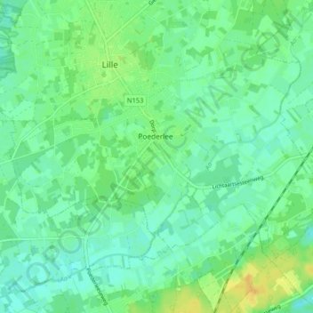
Name: Poederlee topographic map, elevation, terrain.
Location: Poederlee, Lille, Turnhout, Antwerpen, België (51.20695 4.79841 51.23989 4.87868)
Average elevation: 14 m
Minimum elevation: 5 m
Maximum elevation: 29 m
Poederlee ligt in de Kempen op een hoogte van 12-19 meter. In het zuiden stroomt de Aa en in het oosten de Laakbeek die zuidwaarts naar de Aa stroomt.
Other topographic maps
Click on a map to view its topography, its elevation and its terrain.