
Thank you for supporting this site ❤️
Make a donation
Make a donation
Zwiep topographic map
Click on the map to display elevation.
Thank you for supporting this site ❤️
Make a donation
Make a donation
About this map
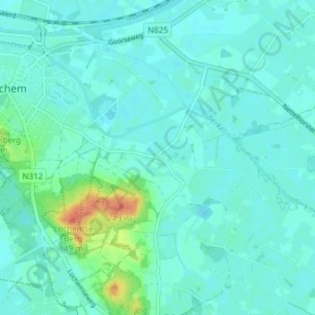
Name: Zwiep topographic map, elevation, terrain.
Location: Zwiep, Lochem, Gelderland, Nederland, 7241 PT, Nederland (52.12971 6.42584 52.16971 6.46584)
Average elevation: 17 m
Minimum elevation: 10 m
Maximum elevation: 51 m
Thank you for supporting this site ❤️
Make a donation
Make a donation
Other topographic maps
Click on a map to view its topography, its elevation and its terrain.