
Thank you for supporting this site ❤️
Make a donation
Make a donation
Ringvoll topographic map
Click on the map to display elevation.
Thank you for supporting this site ❤️
Make a donation
Make a donation
About this map
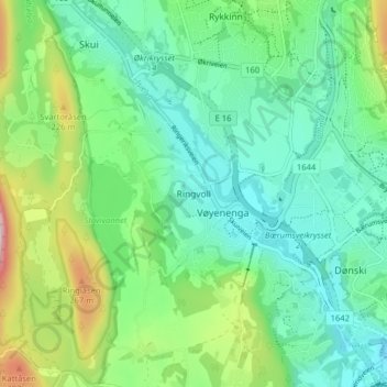
Name: Ringvoll topographic map, elevation, terrain.
Location: Ringvoll, Bærum, Comté d'Akershus, 1339, Norvège (59.89041 10.44873 59.93041 10.48873)
Average elevation: 106 m
Minimum elevation: 5 m
Maximum elevation: 378 m
Thank you for supporting this site ❤️
Make a donation
Make a donation
Other topographic maps
Click on a map to view its topography, its elevation and its terrain.