
Sonntagshorn topographic map
Interactive map
Click on the map to display elevation.
About this map
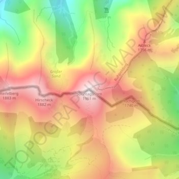
Name: Sonntagshorn topographic map, elevation, terrain.
Average elevation: 1,476 m
Minimum elevation: 945 m
Maximum elevation: 1,928 m
Le Sonntagshorn est une montagne des Alpes du Chiemgau culminant à 1 961 m d'altitude, à la frontière entre l'Allemagne et l'Autriche. Il constitue le point culminant du massif.
Other topographic maps
Click on a map to view its topography, its elevation and its terrain.
Wald-Wild-Schongebiet
Autriche > Salzbourg > Gemeinde Unken
Wald-Wild-Schongebiet, Gemeinde Unken, Bezirk Zell am See, Salzbourg, 5091, Autriche
Average elevation: 1,336 m