
Royal Pines topographic map
Interactive map
Click on the map to display elevation.
About this map
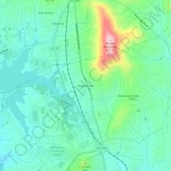
Name: Royal Pines topographic map, elevation, terrain.
Average elevation: 700 m
Minimum elevation: 637 m
Maximum elevation: 903 m
Royal Pines is located in southern Buncombe County at 35°28′39″N 82°30′35″W / 35.47750°N 82.50972°W / 35.47750; -82.50972 (35.477386, -82.509833). It is bordered to the west by U.S. Route 25A and the city limits of Asheville, and to the northeast by Mills Gap Road. Brown Mountain, with an elevation of 2,996 feet (913 m), occupies the center of the CDP.