
Thank you for supporting this site ❤️
Make a donation
Make a donation
Pasir Leba topographic map
Click on the map to display elevation.
Thank you for supporting this site ❤️
Make a donation
Make a donation
About this map
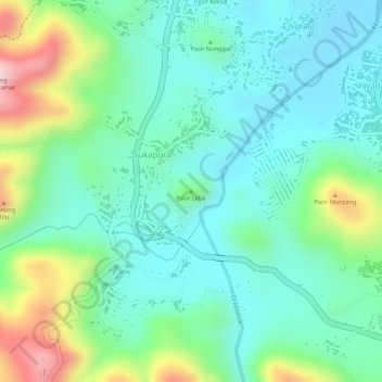
Name: Pasir Leba topographic map, elevation, terrain.
Location: Pasir Leba, Cisurat, Sumedang, West Java, Java, Indonesia (-6.95477 108.07884 -6.95467 108.07894)
Average elevation: 336 m
Minimum elevation: 250 m
Maximum elevation: 538 m
Thank you for supporting this site ❤️
Make a donation
Make a donation