
Maryand topographic map
Interactive map
Click on the map to display elevation.
About this map
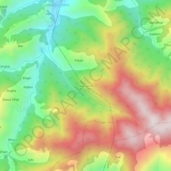
Name: Maryand topographic map, elevation, terrain.
Location: Maryand, Banjar, Kullu, Himachal Pradesh, India (31.52355 77.28917 31.56355 77.32917)
Average elevation: 2,732 m
Minimum elevation: 2,343 m
Maximum elevation: 3,203 m